Central vectors
100 central vector illustrations picked from 30.9M royalty-free files, with no more than 3 per artist so you see real variety. Every file is a scalable EPS that opens in Illustrator, CorelDRAW, Affinity Designer and Inkscape, and exports to SVG or PNG at any size.
-
 Central Park. Urban park in Manhattan, New York City, United States, vector illustration
-
 New York Central Park Poster. Travel vintage postcard, autumn. Vector illustration retro
-
 Ukraine geographic divisions, political map. Eastern European country, split into four areas, used in polls, or for reference or statistical purposes. Western, Eastern, Southern and Central Ukraine.
-
 Designer Poster New York. Callage skyscrapers, Central Park, taxi, Statue of Liberty. Vector drawing
-
 Vector illustration. Central Park, New York. Design for poster, postcard, banner, notebook cover.
-
 Hand drawn illustration of Central Park in NY
-
 Central Asia, or Middle Asia, colored political map. Region of Asia from Caspian Sea to western China, and from Russia to Afghanistan. Kazakhstan, Kyrgyzstan, Tajikistan, Turkmenistan, and Uzbekistan.
-
 Central London Vector Map
-
 Sketch of a central park, New York, hand drawn vector illustration. Vector illustration
-
 Central Asia
-
 Vector map of the Central Asian state of Kazakhstan
-
 North and Central America
-
 Welcome to New York poster for USA travel of America famous landmarks and tourist attractions, Liberty Statue and central park city skyline
-
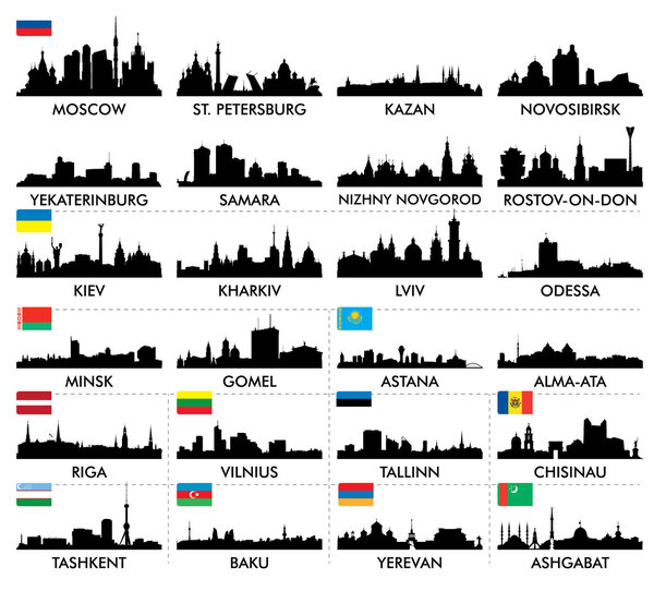 City skyline eastern and northern Europe and Central Asia
-
 Central Asia vector map infographic template divided by countries. Slide presentation
-
 Vector map of the five states of central asia
-
 Central Asia, political map with capitals. Subregion of Asia, consisting of former Soviet republics stretching from Caspian Sea to China and Mongolia, and from Afghanistan and Iran to south of Russia.
-
 Central America and Caribbean islands map classic color, individual states and city whit names vector
-
 Hand drawn sketch of Central park in New York city.
-
 Contour Central America map
-
 Gray Central America map
-
 Green Central America
-
 Central America map, individual states and capital city with names vector
-
 Central America map. High detailed political map Central American and Caribbean region with country, capital, ocean and sea names labeling
-
 Location and Map of the Countries of Central America
-
 Road map of the Central American state Belize
-
 Customer Service Banners
-
 Virtual Links icon
-
 ������������
-
 New york city flag
-
 Buenos Aires map poster, administrative area plan view. Black, white and blue detailed design map of Buenos Aires city with rivers and streets. Outline silhouette of metropolitan cityscape.
-
 New York
-
 Map of Luanda, satellite view, black and white map. Street directory and city map. Africa
-
 List of streets in New York City
-
 The letters NYC on the landscape of new York
-
 New York Manhattan Illustration Map
-
 Chechen Republic country
-
 Black and white printable New York city map, poster design, vector illistration.
-
 New York Street Signs
-
 Santiago One Color Map
-
 New York map
-
 List of streets in New York City, word cloud collage, business and travel concept background
-
 Highly detailed physical map of Russia,in vector format,with all the relief forms,regions and big cities.
-
 Metro de Santiago vector map.
-
 New York American City Landmarks Icons Set Vector
-
 Kazakhstan Administrative divisions
-
 Blue similar New York map. New York map blank. New York map vector. New York map flat. New York map template. New York map object. New York map eps. New York map infographic. New York map clean.
-
 Tourist poster New York. Retro graphics. Vector drawing
-
 Republic of Nicaragua - vector map
-
 Layered editable vector illustration of Urban Traffic Map of Prague,Czech Republic
-
 New York City
-
 Republic of Guatemala - vector map
-
 Dotted map of Russia. Vectoreps10.
-
 New York typography
-
 Vector map with Washim district highlighted in Maharashtra, India
-
 Map of the city of Cincinnati, State Ohio, USA, , and is the government seat of Hamilton County
-
 New York city typography
-
 New York City icons and typography design for cards, banners, tshirts, posters
-
 Vector illustration of the City of Yonkers green road sign
-
 Collage with various words with New York
-
 Layered editable vector illustration of the subway diagram of New York City,the United States of America.
-
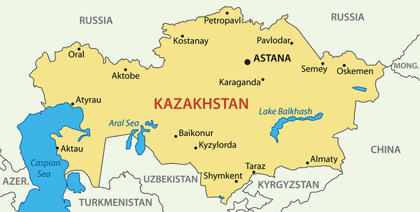 Republic of Kazakhstan - vector map
-
 Layered editable vector illustration of the subway diagram of Boston,USA.
-
 El Salvador flag round bright icon on a white background
-
 Russia map
-
 Highly detailed political road map of Russia
-
 Vector cartoon of man taking photographs in New York with signs
-
 Black and white vector city map of New York with well organized separated layers.
-
 Map of Bangkok city center.
-
 Republic of Poland isolated maps and official flag icon. vector Polish political map icons with general information. European country geographic banner template
-
 Flatiron Building New York.Vector Illustration.
-
 Map of Cuba - Highly Detailed Vector illustration
-
 Map of the center-west region of Brazil with the identified states
-
 Lisbon city plan, detailed vector map
-
 Colored plan map of Moscow, aerial view
-
 Cuba vector set.
-
 Nicaragua round sign Futuristic satelite view of the world centered to Nicaragua Country badge
-
 Blue map of Americas
-
 Kharkiv Line Concept. Vector Illustration of Ukraine University Country Architecture.
-
 Vector map of the city of Dubai, United Arab Emirates, UAE, Dubai-Sharjah-Ajman metropolitan area
-
 Cuba Administrative divisions
-
 New York city. watercolor background. Poster design
-
 Political map of Americas in grey on white background. North and South America with country labels. Simple flat vector illustration
-
 I love new york line icon vector illustration
-
 Nicaragua official national flag, american country, vector illustration
-
 Vector New York state Map silhouette. Isolated vector Illustration. Black on White background.
-
 Brazil - vector map of regions
-
 Nicaragua infographics, statistical data, sights
-
 New York City Skyline: Colorful Abstract Vector Illustration
-
 G20, Group of Twenty, concept of the meeting between Putin and Trump
-
 Brazil, Rio De Janeiro, The Theatro Municipal travel landmark line vector illustration
-
 The detailed map of the Spain with regions or states and cities, capitals
-
 Honduras - detailed map with administrative divisions and country flag. Vector illustration
-
 Kazakhstan blueprint map template with capital city Astana marked on blueprint Kazakhstani map
-
 Chile Administrative divisions
-
 Kazakhstan vector map with administrative regions and capital with grayscale color on white background
-
 Map of the city of Cologne, Germany
-
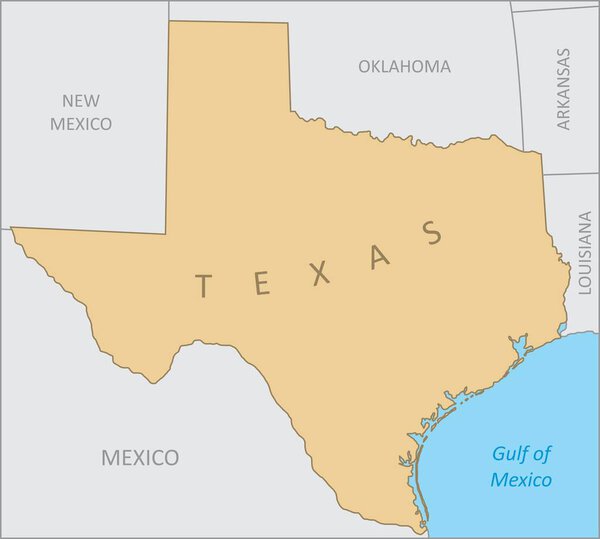 Texas region map
-
 Puerto Rican flag from Puerto Rico, unincorporated territory of the USA - isolated vector illustration
-
 Kazakhstan map Blank vector map of the Country Borders of Kazakhstan for your infographic Vector
Each vector opens in a new tab with its details. Premium files are sold by Depositphotos; we may earn a commission if you buy. How this works.