Land vectors
100 land vector illustrations picked from 28.3M royalty-free files, with no more than 3 per artist so you see real variety. Every file is a scalable EPS that opens in Illustrator, CorelDRAW, Affinity Designer and Inkscape, and exports to SVG or PNG at any size.
-
 Illustration of isometric land section
-
 Seamless grounds, soils and land vector set for UI games
-
 Seamless Grounds, Soil And Grass For Ui Game Illustration of a set of various seamless grounds, soils and land foreground area with blades of grass layers, rocks and underground patterns
-
 Land and aquatic environment
-
 Soil layer infographics, earth texture horizon, subsoil land and underground, vector cross section. Geology soil layer and ground structure diagram with organic topsoil, weathered rock and bedrock
-
 World Environment Day 2024 concept - Land restoration, desertification and drought resilience. Ecology concept. World Environment Day creative banner, poster, social media post, billboard, post card.
-
 Set of horizontal banners with farming landscape, greenhouse, green technologies. Vector illustration of agricultural machinery, hay field, wind turbines, cultivated farm land. Template for web, flyer
-
 Distribution of life on land with geographical climate zones outline diagram
-
 Soil layers diagram with underground water. Geology Underground infographic. Scheme with grass, roots, stones, humus, sand, stones. Land in the section. Mineral particles. Educational illustration
-
 Plot of land with realistic grass
-
 Global environmental problems. Land degradation infographic. Soil erosion, desertification. Vector illustration
-
 Aerial top view of land with sown green fields in countryside harness earth to save the planet concept horizontal copy space vector illustration
-
 Line Landscape Icons
-
 Green Landscape
-
 Natural earth globe
-
 Vector Planet Earth Icon Symbol
-
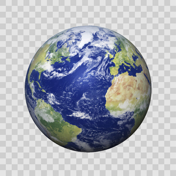 Realistic Earth with shadow on isolated background vector eps10. Elements of this vector furnished by NASA
-
 Concept of Farm Landscape
-
 Construction and civil engineering industry
-
 Farm landscape icon color outline vector
-
 Around the world ( outline of world map with latitude and longitude )
-
 Isometric house illustration
-
 African globe with grid
-
 Globe Icon - Round World Map Vector
-
 Meadow cartoon landscape, great design for any purposes. Cartoon vector illustration.
-
 Earth flat icon.
-
 Sunny rural landscape with hills and fields at dawn. Summer green hills, meadows and fields, blue sky with white clouds.
-
 Fully minimalistic simple empty Meadow green fields landscape, great design for any purposes. Cartoon vector illustration.
-
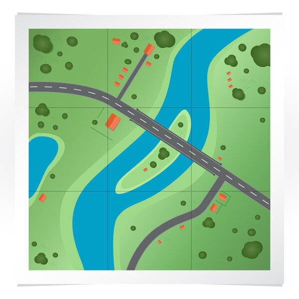 Vector illustration of road map.
-
 Low poly earth illustration on polygonal space background
-
 Rolling hills icons isolated on white
-
 Planet earth icon
-
 Globes
-
 Illustration of boy on island
-
 Vector illustration of beautiful autumn fields landscape with sky and mountains in pastel colors. Countryside concept in flat style.
-
 Vector grove with trees, sun and clouds isolated on white background
-
 Earth with city. Vector concept.
-
 Natural landscape hay field
-
 Mountain summer landscape
-
 Planet
-
 Mountains and forest. Wild nature landscape. Travel and adventure.Panorama. Into the woods. Horizon line.Trees,fog,wood.Backgrounds se
-
 World Globe Maps
-
 Green Landscape with trees, clouds, flowers
-
 Herd of cows and field.
-
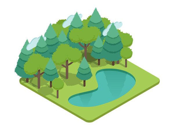 Isometric forest, isometric park, isometric wood, isometric garden landscape with lake, grass, fir-trees and other trees. Isometric ecology vector with nature view. Isometric vector eco nature infographics. Isometric forest trees vector illustration.
-
 Summer landscape with green nature
-
 Modern globe connections network background
-
 Flat design location icon with pin pointer
-
 Curved path over green landscape
-
 Peaceful rural sunset
-
 Vecrot globe icon set.
-
 Globe Vector line Illustrator, EPS 10.
-
 Rural summer landscape a field of ripe wheat on hills and dales in the background. A trees, plants, forest panorama. Hand drawn vector watercolor illustration.
-
 Sushi japanese food vector illustration
-
 Physical map of Earth detailed topographic world
-
 Farm, gardening, agriculture concept
-
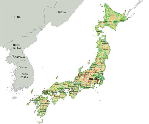 High detailed Japan physical map with labeling.
-
 World Map Showing Tectonic Plates Boundaries illustration
-
 Vintage engraved, hand drawn vineyards landscape, tuskany fields, old looking scratchboard or tatooo style
-
 Vector Pixelated Topographic World Map Miller projection
-
 High detailed China physical map.
-
 World map in french language
-
 Sushi japanese food with fish and chopsticks
-
 Agriculture design template for Agrinews
-
 Vector blue sky clouds. Anime clean style
-
 Pixel game background, cubic pixel grass and ground blocks pattern. 8bit gaming interface design. Game scene background or backdrop with soil layer underground cross section view
-
 United States of America physical map.
-
 Japan map with flag isolated vector eps10
-
 Green field. picturesque hills. vector graphics on the theme of landscape
-
 Forest farm Soil layers geological and underground
-
 Summer landscape
-
 America Centered Physical World Map. No text and borders
-
 Vector diagram of primitive society. Primeval and neighborhood communitys
-
 Soil layer infographic, earth geology formation bedrock, weathered rock fragments, subsoil, topsoil, humus. Vector infographics chart with soil cross section and underground surface
-
 World Map - Highly Detailed Vector Map of the World. Ideally for the Print Posters
-
 Vector illustration on map on atlas
-
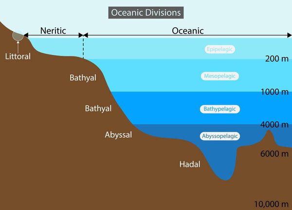 Illustration of physics and geography, Oceanic divisions and depth zones as underwater parts in outline diagram, Mariana trench undersea landscape, Oceanic Divisions
-
 Vector physical map of Kazakhstan. Color map, mountains and plains, rivers and lakes. Major cities, roads and regional boundaries
-
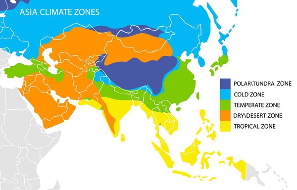 Asia climate zones map, vector geographic infographics
-
 Vector hand drawn village houses sketch and nature
-
 Top view of world map background illustration
-
 High detail vector map of far east Asia
-
 Vector farm field landscape. Furrows pattern in a plowed prepared for crops planting. Rows of soil, rural countryside perspective horizon view. Green stripes sketch illustration.
-
 Political Physical Topographic Colored World Map Pacific Centered
-
 Japan - vector map
-
 Agricultural fields, farming
-
 Asia centered Physical World Map
-
 China Physical Map. No text
-
 Topographic map, vector illustration
-
 Layers of the Earth on white background
-
 America Centered Detailed Physical World Map
-
 Landslide as mountain or cliff collapse geological structure outline diagram
-
 Dark globe centered to Cambodia Country highlighted with red color on world map Satellite world
-
 Forest landscape with river. Top view. Beautiful template with trees, shore and water. Colorful design element for mobile game interface or print. Map with canyon. Cartoon flat vector illustration
-
 Isometric Park Lanes Composition
-
 Beautiful rural countryside with mountain and meadow
-
 Japan mit AKW in grün
-
 Vector map of the world. Oceans and continents on a flat projection.
-
 Map of the city of Mississauga, Canada
-
 Engraving style illustration of countryside agriculture farmland with grassland and barn
Each vector opens in a new tab with its details. Premium files are sold by Depositphotos; we may earn a commission if you buy. How this works.