Geography map vectors
100 geography map vector illustrations picked from 12.4M royalty-free files, with no more than 3 per artist so you see real variety. Every file is a scalable EPS that opens in Illustrator, CorelDRAW, Affinity Designer and Inkscape, and exports to SVG or PNG at any size.
-
 Paper map with red point. Local street gps navigate. City route navigation to marker. Geography distance plan. Vector
-
 Old world map flat vector illustration. Ancient parchment with countries and oceans names. Vintage document with continents, ships and wind rose drawings. Worldwide geography exploration.
-
 World earth planet geography map global travel virtual
-
 World map paper geography icon
-
 Medieval world map. Old paper with painted continents and meridians with wind rose antique geography.
-
 Europe, map. Poster map of the Europe with country names. Print map of Europe for web and polygraphy on business, economic, political, geography themes. Vector Illustration
-
 Folded paper map with pin. Flat city icon with road, street for gps navigation in travel. Route direction marker in place journey. Brochure locator with red mark for geography in web. vector
-
 Dotted world map
-
 Vector world map connection
-
 The world map
-
 World map with labeling.
-
 Street map of town
-
 World map in grey color on white background. High detail blank political map. Vector illustration with labeled compound path of each country
-
 Vintage color political World Map
-
 3D top view of a map with destination location point, Aerial clean top view of the day time city map with street and river, Blank urban imagination map, GPS map navigator concept, vector illustration
-
 Light gray detailed world map
-
 Flat city map colored concept
-
 Urban vector city map of SanJose, California, United States of America
-
 Map city, gps navigator. City area vector background map, streets and water cartography illustration. Widescreen proportion, digital flat design streetmap. Top view. Abstract transportation. Detailed view of city from above.
-
 Seamless pattern in the form of abstract city map. Vector repeating flat illustration with a city road plan. Decorative map with town streets, green parks and a blue river. Color schematic background
-
 Abstract city map. Town district plan. City center scheme. Vector illustration
-
 Abstract city map vector illustration with streets, parks and ponds
-
 Abstract line world map
-
 Abstract topographic map
-
 Fictional city map navigation
-
 Urban vector city map seamless texture
-
 Seamless Texture City Map in Retro Style. Outline Map
-
 Doodle town. Map.
-
 Mexico map
-
 Map of the city of Ashgabat, Turkmenistan
-
 Vector world map illustration in polygonal style
-
 Vector illustration shows approximately migratory of the Monarch butterfly. The map is a schematic preview, only just to describe migratory routes.
-
 Europe physical map.
-
 USA Map in Cartoon Style
-
 Israel highly detailed physical map,in vector format,with all the relief forms,regions and big cities.
-
 Map of London
-
 World map dot illustration
-
 Map city. Graphic plan town with streets, river, bridges, green parks, buildings and roads. Urban background with location, navigation for gps, travels and guides. Aerial pattern cartography. Vector.
-
 Seamless pattern with globe, compass, world map and wind rose. Vintage science objects set in steampunk style. Vector illustration
-
 United States of America physical map
-
 World map with color points
-
 Vector map
-
 World map illustration infographics
-
 Funny cartoon world map with childrens of different nationalities, animals and monuments of all the continents and oceans. Names in spanish.
-
 Earth Map Icon
-
 Map of the United States of America
-
 Watercolor world map in vector.
-
 Black and dark grey Birmingham city area vector background map, streets and water cartography illustration. Widescreen proportion, digital flat design streetmap.
-
 Tambov Oblast All Districts Blue Flat Map Illustration
-
 Kursk Oblast All Districts Blue Flat Map Vector Illustration
-
 Novgorod Oblast All Districts Blue Flat Map Vector Illustration
-
 World map polygon on dark background
-
 Main road throughout map. Navigation mapping technology for obtaining data on distance and turns of the path. Path from
-
 World map with country name
-
 Geographic map of france with a reflection
-
 World Map Collage of Cannabis Items
-
 Caribbean -highly detailed map.
-
 Norway map with flag
-
 Political world map isolated on white background, vector illustration
-
 World Map and Information Graphics
-
 Doodle city map.
-
 Map with a pin
-
 Vector still life subjects of geography
-
 Abstract city map. Print with town topography. City residential district scheme. Vector illustration
-
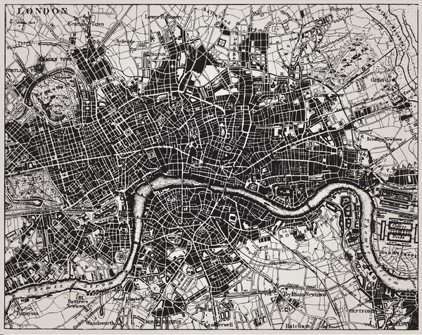 Historical map of London, England.
-
 Folded location map with marker. Roma City,Italy, map with pin pointer,vector element template image
-
 High Detail Grey World Map
-
 Dark green map of Europe.
-
 Geography
-
 Generic City Map.
-
 World map map retro
-
 Pin map with Isle of Man flag on world map. Vector illustration.
-
 City map. Town streets with park and river. Downtown gps navigation plan, abstract transportation urban. Vector maptown small road pattern texture
-
 Political World Map with flat icons and globes.Vintage colors
-
 World map infographic with color pointers. Vector illustration.
-
 Tourist map of the area for navigation orientation vector illustration
-
 Vector illustration of road map and compass in cartoon style isolated on white background.
-
 World travel map vector illustration
-
 World Map isolated on retro white color background with labeling
-
 Molucca Sea on the world map. Vector illustration.
-
 Stylized low poly World Map concept with wired construction of connection concept. Globes business background. Vector illustration.
-
 Top view of a blank map template, Aerial clean top view of the day time city map with street and river, Blank urban imagination map, GPS map navigator concept, vector illustratio
-
 Vector map of the Central Asian state of Kazakhstan
-
 Illustrated map of the state of Alaska
-
 Political World Map vector illustration isolated on white background with country names in spanish. Editable and clearly labeled layers.
-
 Physical World Map Retro Colors with labeling
-
 Earth, globe icon. Vector. World map isolated on white background.
-
 VINTAGE WORLD MAP
-
 Simplified blank schematic map of World. Political map of countries with generalized borders. Simple flat vector illustration
-
 Abstract city map. City residential district scheme. City district plan. Vector illustration
-
 High detail world map. vector illustration of earth map
-
 Map of the city center. GPS map navigator concept. Vector illustration. Eps 10.
-
 Doodle Paper tourist map of the area. A tool for navigation, orientation on the terrain. Equipment for tourism, travel, hiking, sports. Outline black and white vector illustration isolated on a white.
-
 Blue circles world map background
-
 Set elements of infographics. World Map and Information Graphics
-
 Vector map of Lublin. Street map poster illustration. Lublin map art.
-
 Political world map on white background, with every state labeled and selectable (labeled in Layers panel also). Versatile file, turn on an off visibility and color of each country in one click.
-
 Downtown vector map of Copenhagen, Denmark
-
 Tourist infographics about Finland. Cartoon map of Scandinavian country. Travel illustration with landmarks, buildings, food and plants. National symbols. Famous attractions. Vector illustration
-
 Folded Paper Map In Hand
Each vector opens in a new tab with its details. Premium files are sold by Depositphotos; we may earn a commission if you buy. How this works.
