Geographic map vectors
57 geographic map vector illustrations picked from 12.5M royalty-free files, with no more than 3 per artist so you see real variety. Every file is a scalable EPS that opens in Illustrator, CorelDRAW, Affinity Designer and Inkscape, and exports to SVG or PNG at any size.
-
 England Dotted Map in Black and White. Minimal Geographic Point Illustration.
-
 World Map with Country Green, World Map, Geographic Map, Country Map, Country Border line, Asia, Africa, Europe, North America, South America, Australia Oceania
-
 Topographic map of Ukraine. Geographic map of Ukraine with borders of the regions. High detailed Ukraine physical map with labeling. Atlas of Ukraine with rivers, lakes, seas, mountains and plains.Vector illustration
-
 Geographic map. planet earth map from flowers. flowers.
-
 The set of national profile of the geographic maps of the israel
-
 The set of national profile of the geographic maps of the slovenia, slovakia
-
 Japan geographic map
-
 Hexagon Blue Costa Rica map. Geographic map in blue color tints on a black background. Vector collage of Costa Rica map made of hexagon spots.
-
 Vector illustration of Brazil geographic map
-
 Colored world map with country names
-
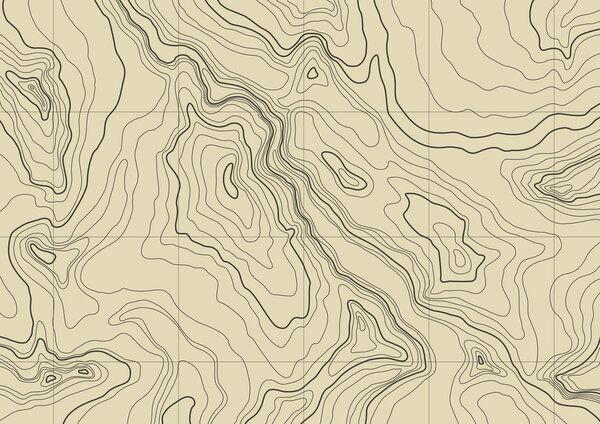 Abstract topographic map
-
 Black and white political map of the world vector
-
 Triangle Map abstract isolated on a white backgrounds
-
 Cartoon map of Sochi, Russia
-
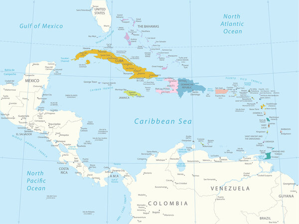 Caribbean - highly detailed map.
-
 World map with geographical objects names
-
 Sehore District Map Highlighted on Madhya Pradesh State Map
-
 Prayagraj District Highlighted in Uttar Pradesh State Map of India
-
 Firozabad District Highlighted in Uttar Pradesh State Map of India
-
 Soft blue gradient political world map
-
 Road map of the Kingdom of Morocco
-
 Black and white geographical map. Continents: Asia, Europe, Nort
-
 Asia political map
-
 Line art Netherlands map. continuous line europe map. vector illustration. single outline.
-
 Detailed United States of America map
-
 South America - highly detailed map.
-
 Overview map of Mexico with the most important cities
-
 Detailed World Map
-
 Political map of European continent. Versatile file, easy editable color and visibility of every state in one click in layers panel
-
 World map divided into six continents. Different color for each continent with country bordes in white stroke. Simple flat vector illustration
-
 Europe political map
-
 Map of Mexico City or CDMX without names of the mayors
-
 Map of Mexico City or CDMX with names of the mayors
-
 North America political map
-
 World map and infographic on monitor display. Vector illustration, EPS 10
-
 Map of the United Kingdom with political divisions on a white background, infographic
-
 Line art Ukraine map. continuous line europe map. vector illustration. single outline.
-
 Line art Czech map. continuous line europe map. vector illustration. single outline. Vector illustration
-
 World map 3D vector illustration. Useful for infographics Global concept.
-
 Colored Dotted World Map
-
 Stylized map of India. Isometric 3D
-
 Switzerland map icon illustration design
-
 Stylized Colorful political map of Europe. With country name labels.
-
 Map of europe
-
 Dot Brazil Map with Blue Variant
-
 Detailed location map of South America, very easy, fully editable, with instruction details in separate layer, vector
-
 Hand drawn vector illustrated map of Israel Jewish sketch illustration, doodle element Isolated national map made in vector Sand colors Geographical map showing desert and planted areas. Doodle ribbon
-
 Vector Contour Dotted Map of Connecticut State with Caption
-
 Vector Flat Map of Mediterranean Sea with Name
-
 Vector Flat Map of Delaware State with Name
-
 Map of Maghreb countries - Northwest Africa states. Vector illustration
-
 German Map Collage of Wine Glass Items in German Flag Colors
-
 Vector set of Israel country.
-
 3D Wireframe Terrain
-
 Mexico Infographics
-
 South america
-
 Ukraine seamless pattern
Each vector opens in a new tab with its details. Premium files are sold by Depositphotos; we may earn a commission if you buy. How this works.
