Department border vectors
91 department border vector illustrations picked from 12.1M royalty-free files, with no more than 3 per artist so you see real variety. Every file is a scalable EPS that opens in Illustrator, CorelDRAW, Affinity Designer and Inkscape, and exports to SVG or PNG at any size.
-
 Detailed map of the Region of Normandy (France) with borders of municipalities, subdistricts (cantons), districts (arrondissements), and departments (departements). Vector illustration
-
 Detailed map of the French region Hauts de France (France) with borders of municipalities, subdistricts (cantons), districts (arrondissements), departments (departements), and region
-
 Detailed map of the French region of Brittany (Bretagne, France) with borders of municipalities, subdistricts (cantons), districts (arrondissements), departments (departements), and region
-
 White vector map of Guatemala with black borders of it's departments
-
 Fireman emblem sign on white background. fire department symbol. flat style.
-
 Centre Val de Loire Map with All Departments Black Line Vector Illustration of French Region
-
 France regions and departments
-
 Nouvelle-Aquitaine administrative map divided in departments with labels, France
-
 Santa Cruz Department (Plurinational State of Bolivia, Departments of Bolivia) map vector illustration, scribble sketch Santa Cruz ma
-
 High quality map of Belarus with borders of the regions on white background
-
 Colombia departments Map black country
-
 Slovakia political map of administrative divisions - regions. Blank outline map. Solid thin black line borders.
-
 Map of Department of Martinique, vector illustration
-
 Ile-de-France, departments and prefectures of the Paris Region, political map. Most populous of the regions of France, centered on the capital Paris, located in the north-central part of the country.
-
 Antioquia Department map vecto
-
 Guatemala department blank outline map
-
 Colombia departments Map grey
-
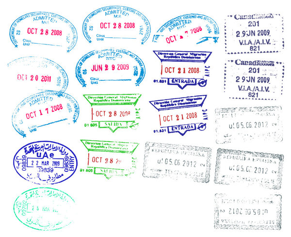 Border Stamps
-
 France administrative regions and departments vector map with neighbouring countries and territories
-
 Blank Fire Department badge icon linear logo mark set collection in black and white for web
-
 Ariege department blank outline map
-
 Black location map of the Honduran Choluteca department inside gray map of Honduras
-
 Black location map of the Honduran Ocotepeque department inside gray map of Honduras
-
 Ile-de-France, departments and prefectures of the Paris Region, multi colored political map. Most populous region of France, centered on the capital Paris, located in the countries north-central part.
-
 The Neuquen province isolated map divided in departments with labels, Argentina
-
 Benin map with departments and labels black
-
 Manipur, map of India with state borders
-
 San Miguel Department (Republic of El Salvador, Departments of El Salvador) map vector illustration, scribble sketch San Miguel map
-
 The Cordoba province isolated map divided in departments with labels, Argentina
-
 Silhouette contour border map of Spain
-
 Map of Czechia and location on Europe map. Vector illustration
-
 Mubarak Al Kabeer governorate, administrative division of the country of Kuwait. Vector illustration.
-
 Map of Andalusia autonomous community of Spain and location on Spanish map
-
 Concept rejected working American visa, top view. Employees hands approved American visa. Table at the embassy. Vector illustration in a flat style.
-
 Administrative map of the new french region Bourgogne Franche Comte
-
 Indonesia political map of administrative divisions - provinces and special regions. Grey blank vector editable map EPS.
-
 Channel Islands map. Vector illustration.
-
 France 2-digit postcodes postal codes vector map
-
 Illegal migrant man standing on a mugshot photo shooting background, vector illustration.
-
 Madeira map, administrative division of Portugal. Vector illustration.
-
 France map
-
 Colorful outlines map of France with names on white background
-
 Map of Lower Normandy
-
 France contour map
-
 Map of Burgundy
-
 Blank Firefighter Maltese Cross Outline Isolated Vector Illustration
-
 Empty storefront with floral seamless background.
-
 Interactive map of metropolitans French regions on white background
-
 Leicester Downtown Vector Map
-
 Map of Champagne-Ardenne
-
 Simple gray administrative map of the new french region normandie
-
 Fireman emblem sign on white background. firefighter white emblem St Florian symbol. flat style.
-
 Europe outline silhouette map with countries
-
 Vector Rubber Stamps
-
 Administrative map of the new french region Hauts de France
-
 Outline blue map of Berlin
-
 New ile de france administrative and political vector map, france
-
 Vector map Maldives. Isolated vector Illustration. Black on White background. EPS 10 Illustration.
-
 Schleswig-Holstein state map, Germany, vector map silhouette illustration isolated on Germany map. Editable blank vector map. Province in Germany.
-
 Saarland state map, Germany, vector map silhouette illustration isolated on Germany map. Editable blank vector map. Province in Germany.
-
 Outline France map
-
 Beautiful and colorful detailes map of France with french islands, new regions and capitals. French names. Vector illustration.
-
 Blank map Cauca Valley of Colombia. High quality map Cauca Valley with municipalities on transparent background for your web site design, logo, app, UI. Colombia. EPS10.
-
 Sachsen map, Saxony state, Germany, vector silhouette illustration isolated on Germany map. Editable blank vector map. Province in Germany.
-
 Italy chart
-
 Map of Canada. Black and blind maps
-
 Passport stamps
-
 Back To School card. Green chalkboard, Graduation Cap and autum
-
 Travel background with stamps
-
 Woman shopping pattern
-
 Set of Stamps and Badges
-
 Grey Europe map Vector illustrations
-
 Map of French Guiana
-
 Colorful map of Spain with spanish names of provinces and cities. Vector illustration.
-
 Blank Map of France
-
 Cartoon job seamless pattern
-
 Retro label or vintage badge
-
 Travel around the world. Greenland. Watercolor map
-
 Blank map Province Gelderland of Netherlands. High quality map Gelderland with municipalities on transparent background for your web site design, logo, app, UI. EPS10.
-
 Greece -highly detailed map.
-
 Moldova country map vector with regional areas
-
 Stamp Moscow, Russia
-
 Conference Room Meeting Flat Vector Illustration
-
 Lebanon map in gray on a white background
-
 Blank map Province East Flanders of Belgium. High quality map East Flanders with municipalities on transparent background for your web site design, logo, app, UI. EPS10.
-
 Latin_America07-07
-
 Us citizenship and immigration services
-
 Israel political map of administrative divisions - districts, Gaza Strip and Judea and Samaria Area. 3D isometric blank vector map in shades of grey.
-
 Democratic Republic of Congo country map vector with regional areas
-
 Creative vector illustration of passports with globe map isolated on transparent background. Art design. Front cover international identification document. Abstract concept graphic element.
-
 Map Reunion. Reunion Map Outline. La Reunion vector map with the flag inside.
Each vector opens in a new tab with its details. Premium files are sold by Depositphotos; we may earn a commission if you buy. How this works.


