Continents planet ocean vectors
100 continents planet ocean vector illustrations picked from 5.9M royalty-free files, with no more than 3 per artist so you see real variety. Every file is a scalable EPS that opens in Illustrator, CorelDRAW, Affinity Designer and Inkscape, and exports to SVG or PNG at any size.
-
 World color map continents
-
 World map, colorful continents atlas EPS10 vector file.
-
 Earth globes over continents
-
 Set of vector globe icons showing earth with all continents. Vector illustration.
-
 Continents and countries on the world map marked.
-
 Seven continents vector
-
 Planet
-
 Detailed vector map of the Atlantic Ocean
-
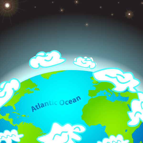 Illustration of Atlantic ocean on Earth
-
 Illustration of Indian ocean on Earth
-
 Vintage world map. Retro countries boundaries on topographic or marine map. Old continents navigation maps vector illustration
-
 Earth globes. Flat planet Earth neon icon. Vector stock illustration
-
 Hand-draw planet Earth in space
-
 World color map continents and country name
-
 Vector earth globe with green continents. modern world map concept. world map realistic blue ball illustration
-
 Planet Earth
-
 World map, Globes with countries. Planet Earth. Vector
-
 Vector map of the planet with animals
-
 Vector paper earth world map. Modern style 3d blue, green, yellow color illustration of continent with shadows and elevation. Globe design element for travel, infographic, report, advertisment.
-
 Green Lightning Planet Earth
-
 Political world map on transparent background, black color earth continents silhouette vector illustration
-
 7 continents in the world with white background
-
 Map of World. Detailed thin black outline political map with country, sea and ocean names. Vector map
-
 Pangaea. Supercontinent and Modern continents. Continental drift on globe of the planet Earth. vector illustration
-
 Earth globe - world map with continents on planet Earth, vector illustration on white background
-
 Child Drawing Sketch Of Planet Earth
-
 Globe map of the world, planet Earth. Ground contour with shadow. Vector illustration.
-
 Silhouette of a world map with all continents and large Islands, all countries, vector
-
 Globe Earth in cartoon style with blue oceans and green continents. Globe Earth icon. Vector illustration
-
 World planet earth with maps isolated
-
 Vector map of land with animals around the planet
-
 Planet earth at night. Dark sphere with city lights on a white background. Highly realistic illustration.
-
 Earth globes isolated on white background. Flat planet Earth icon. Vector stock illustration.
-
 Colorful vector world map complete with all countries and capital cities names.
-
 World map countries colorful. Vector illustration.
-
 World map paper in vector
-
 Colorful vector World Map
-
 Vector outline of political world map
-
 Six black and white vector Earth globes
-
 Animals world map
-
 Globe
-
 Natural earth globe
-
 Illustration of children around the world
-
 Vector world map with major marine currents
-
 World Whale and Dolphin Day. 23 July. Concept of ecological holiday. Silhouettes Dolphin and Whale. Event name
-
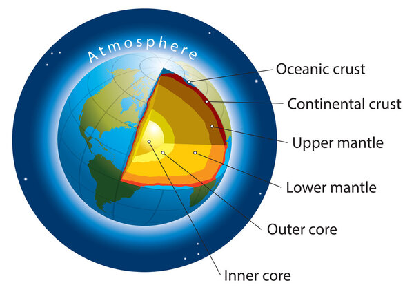 Earth layers
-
 Vector Pixelated Topographic World Map Miller projection
-
 Plate Tectonics World
-
 World map with countries names.High detailed Vector world map complete with all countries names in blue background drawing by illustration
-
 Earth map with the name of the countries
-
 Plate Tectonics German
-
 Plate Tectonics SPANISH TEXT
-
 Earth seen from space, Elements of this vector furnished by NASA
-
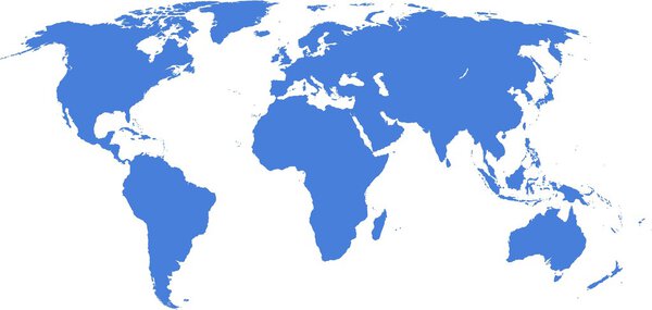 Word map
-
 Political World Map
-
 Timezone map
-
 High Detail Central america Green vector Map Set
-
 Detailed Political World Map
-
 World Map Texture
-
 Vector map of animals on a black background
-
 Standard Time Zone Of The World
-
 Earth - America
-
 WORLD on a black background Canada, USA and South America
-
 The Earth
-
 Blank political map of Australia. 3D Earth globe with black outline map. Vector illustration
-
 Color circle global america map geography vector illustration
-
 Colorful Classic Robinson projection vector map of the World, cleverly layered and with names of all countries, capitals and main cities, main geographical features.
-
 Detailed political world map vintage style Miller projection
-
 Colored abstract terrestrial globe
-
 Doodle circle global america map geography vector illustration
-
 Blank political map of Australia. 3D Earth globe with colored map. Vector illustration
-
 World Map on background, close up
-
 Earth globe isolated on a white background with shadow. Elements of this image furnished by NASA - vector
-
 Earth globe 3D gold, realistic icon with parallels and meridians, vector world sphere design.
-
 Pacific Centred World Political Map. Countries and capitals, cities, borders and water objects, state outline. Detailed World Map vector illustration.
-
 Earth globe illustration isolated on white background.
-
 Earth balloon
-
 Earth globes set, different views with parallels and meridians, isolated vector world spheres design.
-
 Earth globe 3D icon
-
 Detailed World Map
-
 Earth hemispheres
-
 Blank political World Map with with rivers, lakes, seas and ocea
-
 WORLD on a black background North and South America, Africa and Europe
-
 WORLD on a black background Europe, Middle East and Africa
-
 Large detailed political World Map with water objects
-
 Vector World Map with Globes Set
-
 Latitude and longitude
-
 Latitude-longitude-coordinates
-
 Vector political dark grey world map
-
 Earth globe illustration on dark background.
-
 Globe 3d blue green vector set
-
 Set of globes of Earth. World map in globe shape. Vector illustration. Eps 10.
-
 Starry world
-
 Highly detailed political world map
-
 Time Zone Blue Map. Detailed World Map with Countries Names. Vector Illustration.
-
 Single Color Icon - Globe
-
 High detail vector map of far east Asia
-
 World map of Pangaea, Laurasia, Gondwana and sea Tetis
-
 Green Earth - preservation of Nature
-
 School globe icons. Vector Illustration of a Cartoon Model of the Globe. Subject for the Study of Geography at School
Each vector opens in a new tab with its details. Premium files are sold by Depositphotos; we may earn a commission if you buy. How this works.