Continents geography vectors
100 continents geography vector illustrations picked from 16.8M royalty-free files, with no more than 3 per artist so you see real variety. Every file is a scalable EPS that opens in Illustrator, CorelDRAW, Affinity Designer and Inkscape, and exports to SVG or PNG at any size.
-
 A vibrant watercolor world map showcases various colors blending beautifully. Each continent features a unique hue, enhancing its artistic appeal while highlighting global geography.
-
 World map vector states border geography continent global business travel flat graphic earth globe planet worldwide black background
-
 Green world map with continent and country borders in flat style. Editable vector illustration for geography and environmental projects.
-
 World map, colorful continents atlas EPS10 vector file.
-
 World color map continents
-
 Set of monochrome icons with continents for your design
-
 Illustrated map of the world with all continents
-
 World Continents
-
 Continental drift chronological movement, historical timeline with earth continents: Pangaea, Laurasia, Gondwana.
-
 Earth globes over continents
-
 Political World Map vector illustration with different colors for each continent and isolated on white background. Editable and clearly labeled layers.
-
 Set of vector globe icons showing earth with all continents. Vector illustration.
-
 Political World Map vector illustration with different colors for each continent and different tones for each country. Editable and clearly labeled layers.
-
 Color circle global america map geography vector illustration
-
 Continents and countries on the world map marked.
-
 Seven continents vector
-
 Geography doodles.
-
 Globe sign icon. World map geography symbol.
-
 World Map decent low poly style continents Vector illustration
-
 World map template with continents flat Earth worldwide map
-
 Political blank World Map vector illustration with different colors for each continent and different tones for each country. Editable and clearly labeled layers.
-
 School Globe Planet Earth. Vector Illustration of a Cartoon Model of the Globe. Subject for the Study of Geography at School
-
 School globe icons. Vector Illustration of a Cartoon Model of the Globe. Subject for the Study of Geography at School
-
 Dot Style World Map With Continents
-
 Landmarks world map vector cartoon illustration. Cartoon globe vector illustration. landmarks, signs, animals of countries and continents. Abstract map for learning. Poster, picture, card
-
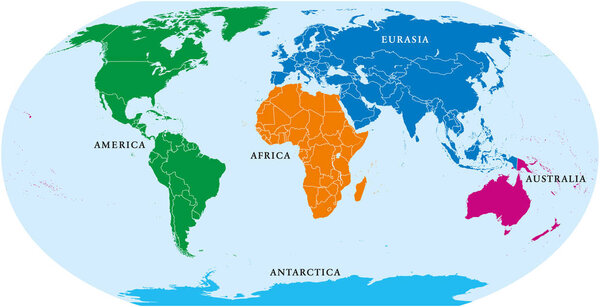 Five continents world, political map. Africa, America, Antarctica, Australia and Eurasia, with shorelines and borders. Robinson projection. English labeling. Isolated on white background. Vector.
-
 World planet earth geography line style icon
-
 Political world map on white background, with every state labeled and selectable. Colored by continents. Versatile file, turn on an off visibility and color of each country in one click
-
 Blank outline map of World. Worksheet for geography teachers usable as geographical test in school lessons
-
 Four continents map. America, Africa-Eurasia, Australia and Antarctica. Political map with shorelines under Robinson projection. English labeling. Isolated on white background. Vector.
-
 Global Landmass Distribution and Geographical Diversity of World Continents
-
 World map with travel routes, destinations and landmarks from all continents: vacations and traveling concept
-
 World color map continents and country name
-
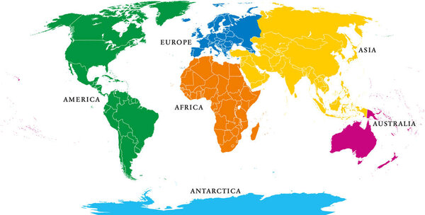 Six continents, political world map, with borders. Africa, America, Antarctica, Asia, Australia and Europe. Robinson projection. English labeling. Isolated illustration on white background. Vector.
-
 Globe on stand representing geography and global learning
-
 Set of halftone continents for design
-
 World Map: Continuous One Line Drawing Illustrating Geography Concept in Minimalist Hand-Drawn Design.
-
 Vector Colorful World Map with all continents in different colors and Earth globe with matching colors.
-
 World Map brilliant low poly style continents Vector illustration
-
 Black and white geographical map. Continents: Asia, Europe, Nort
-
 Vector earth globe with green continents. modern world map concept. world map realistic blue ball illustration
-
 Earth's city lights map with silhouettes of continents
-
 Map of the world. World map. Vector design.
-
 Dotted world map
-
 Vintage colors vector political World Map
-
 Orange detailed world map with Earth globes
-
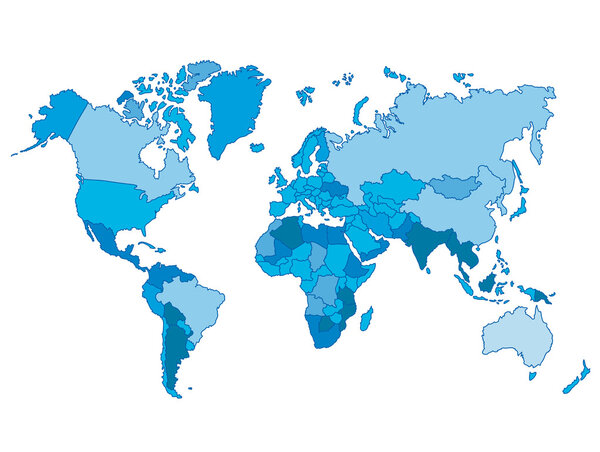 Political world blue map and vector illustration
-
 Colorful vector world map complete with all countries and capital cities names.
-
 World map countries colorful. Vector illustration.
-
 World map paper in vector
-
 High detail world map. vector illustration of earth map
-
 Africa yellow glowing neon icon
-
 Vector outline of political world map
-
 Detailed Political World Map
-
 Six black and white vector Earth globes
-
 Globe
-
 Animals world map
-
 Earth
-
 Earth globes
-
 Blank Political World Map vintage color with lakes and rivers
-
 American kids cartoon
-
 High Detailed Political countries World Map. Vector illustration
-
 Black world map outlines on white
-
 Colored world map with country names
-
 Map of the world silhouette
-
 Detailed vector map of the Atlantic Ocean
-
 Vector Timezone world map
-
 World planet earth icon
-
 Map illustration of Bahrain with the flag. Cartographic illustration of Bahrain and neighboring countries.
-
 World Map World Map Atlas blue
-
 WORLD on a black background Canada, USA and South America
-
 Sketchy World Map
-
 Detailed political world map with capitals, rivers and lakes
-
 Earth globes with world map
-
 Africa map, with names of individual states, infographics blue flat design vector
-
 World map with countries names.High detailed Vector world map complete with all countries names in blue background drawing by illustration
-
 Large detailed political World Map with water objects isolated o
-
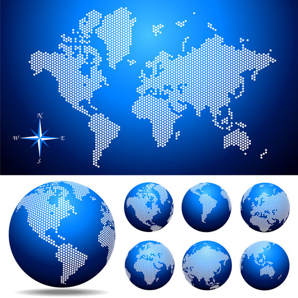 Vector dotted Map and Globe of the World
-
 World map with globe. with white background
-
 World map one line art. Continuous Earth line drawing symbol. Earth globe hand drawn insignia. Vector illustration isolated on white background
-
 Stylized World Map concept with biggest cities
-
 World map with flag
-
 Map of World. Detailed thin black outline political map with country names. Vector map
-
 Time Zone Blue Map. Detailed World Map with Countries Names. Vector Illustration.
-
 Grey map of the world with indication of Chile
-
 Mediterranean region
-
 North pole
-
 Detailed World Map
-
 Very high detailed map of the world, with slight 3 D appearance, placed on gray ellipse background,vector
-
 3d world map with color confetti.
-
 Modern Digital World Map Globalization Concept. Vector Illustration
-
 Pixel dots vector world map in color and in grey. Colorful rainbow and blue gradient dotted world map.
-
 Vector Illustration Colorful Map Of The World With Country Names
-
 World map. 3D globe world map. Vector Illustration
-
 Happy Globe Guy
-
 Punkt welt
-
 Navy map of the world.
-
 "Earth Globe Icons Set: World Map, Earth Planet, Global Symbols"
-
 Editable world map vector with political borders, each country on separate layer. Fully customizable outline map isolated on transparent background for design, print and infographic use
-
 Vintage word map grunge background with retro compass. Vector illustration.
Each vector opens in a new tab with its details. Premium files are sold by Depositphotos; we may earn a commission if you buy. How this works.