Continents cartography vectors
100 continents cartography vector illustrations picked from 13.5M royalty-free files, with no more than 3 per artist so you see real variety. Every file is a scalable EPS that opens in Illustrator, CorelDRAW, Affinity Designer and Inkscape, and exports to SVG or PNG at any size.
-
 World map, colorful continents atlas EPS10 vector file.
-
 Set of monochrome icons with continents for your design
-
 World map with continents
-
 Illustrated map of the world with all continents
-
 World Continents
-
 A vibrant watercolor world map showcases various colors blending beautifully. Each continent features a unique hue, enhancing its artistic appeal while highlighting global geography.
-
 Continental drift chronological movement, historical timeline with earth continents: Pangaea, Laurasia, Gondwana.
-
 Political World Map vector illustration with different colors for each continent and isolated on white background. Editable and clearly labeled layers.
-
 Political World Map vector illustration with different colors for each continent and different tones for each country. Editable and clearly labeled layers.
-
 Continents and countries on the world map marked.
-
 World map with colorful continents and flat map pointers
-
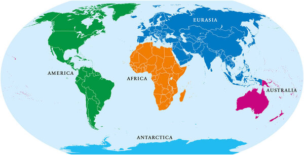 Five continents world, political map. Africa, America, Antarctica, Australia and Eurasia, with shorelines and borders. Robinson projection. English labeling. Isolated on white background. Vector.
-
 Political world map on white background, with every state labeled and selectable. Colored by continents. Versatile file, turn on an off visibility and color of each country in one click
-
 Four continents map. America, Africa-Eurasia, Australia and Antarctica. Political map with shorelines under Robinson projection. English labeling. Isolated on white background. Vector.
-
 Detailed vector World map with colorful continents and flat map
-
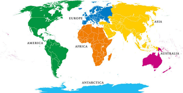 Six continents, political world map, with borders. Africa, America, Antarctica, Asia, Australia and Europe. Robinson projection. English labeling. Isolated illustration on white background. Vector.
-
 World map with colorful continents and flat map pointers isolate
-
 Black and white geographical map. Continents: Asia, Europe, Nort
-
 Vintage world map. Retro countries boundaries on topographic or marine map. Old continents navigation maps vector illustration
-
 Vector illustration of a world map with continents in different colors. Perfect for education, geography, travel, and infographic projects.
-
 Square dotted world map and earth globes showing all continents
-
 Square dotted world map and earth globes showing all continents. Vector illustration template for web design, annual reports, infographics, business presentation, marketing, travel and tourism.
-
 An illustration of cartoon educational world map for children. Banner and poster for nursery. America, Europe, Asia, Africa, Oceania, Antarctica. Continents and oceans.
-
 Illustration of a vibrant world map divided into continents
-
 Infographics of World map, individual continents vector
-
 Continents vector map illustration. World map divided into six continents. Simple flat vector illustration.
-
 Silhouette of a world map with all continents and large Islands, all countries, vector
-
 Vector paper earth world map. Modern style 3d blue, green, yellow color illustration of continent with shadows and elevation. Globe design element for travel, infographic, report, advertisment.
-
 World globe map with colored continents and country labels. Editable vector illustration for geography and educational design projects.
-
 Political world map on transparent background, black color earth continents silhouette vector illustration
-
 Illustration of the continents of the worls on white background
-
 Vintage colors vector political World Map
-
 Colorful vector world map complete with all countries and capital cities names.
-
 World map countries colorful. Vector illustration.
-
 World map paper in vector
-
 Colorful vector World Map
-
 Geographic design
-
 Globe
-
 High Detailed Political countries World Map. Vector illustration
-
 Detailed vector map of the Atlantic Ocean
-
 Vector Timezone world map
-
 Map illustration of Bahrain with the flag. Cartographic illustration of Bahrain and neighboring countries.
-
 Earth - America
-
 Africa map, with names of individual states, infographics blue flat design vector
-
 World map with countries names.High detailed Vector world map complete with all countries names in blue background drawing by illustration
-
 Political World Map vector illustration. Editable and clearly labeled layers.
-
 Political map of World
-
 Stylized World Map concept with biggest cities
-
 Map of World. Detailed thin black outline political map with country names. Vector map
-
 Grey map of the world with indication of Chile
-
 Mediterranean region
-
 Hi Detail colored Vector Political World Map illustration
-
 Vector Illustration Colorful Map Of The World With Country Names
-
 World map. 3D globe world map. Vector Illustration
-
 Navy map of the world.
-
 Editable world map vector with political borders, each country on separate layer. Fully customizable outline map isolated on transparent background for design, print and infographic use
-
 Detailed Political World Map
-
 Hi Detail Vector Political World Map illustration
-
 Vintage word map grunge background with retro compass. Vector illustration.
-
 Vector world map with major marine currents
-
 World map on an old piece of paper
-
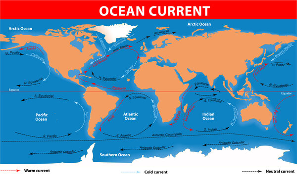 Ocean surface currents
-
 Modern Detailed Globe Map Isolated on White Background in Light Grey Color. Vector Illustration
-
 Stylized images of different rotation phases of globe
-
 World Map: Continuous One Line Drawing Illustrating Geography Concept in Minimalist Hand-Drawn Design.
-
 Political world map Van der Grinten projection
-
 Black North America map
-
 Low polygons vector world map silhouette.
-
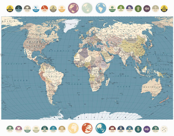 Retro Color World Map and Round Flat Icons. Detailed World Map vector illustration.
-
 Colorful Classic Robinson projection vector map of the World, cleverly layered and with names of all countries, capitals and main cities, main geographical features.
-
 World travel map vector illustration
-
 Vintage Vector Map of the world
-
 Grunge, rustic world map
-
 Map of Pangaea with modern continental borders. Continental drift on the planet Earth. millions years ago. vector illustration for educational and science use
-
 Blue World Divided Map With Countries
-
 World Map vector. Blue similar world map blank vector on white background. Blue similar world map with borders of all countries and States of USA map. High quality world map. EPS10.
-
 Hand drawn world map
-
 Map illustration of Philippines with the flag. Cartographic illustration of Philippines and neighboring countries.
-
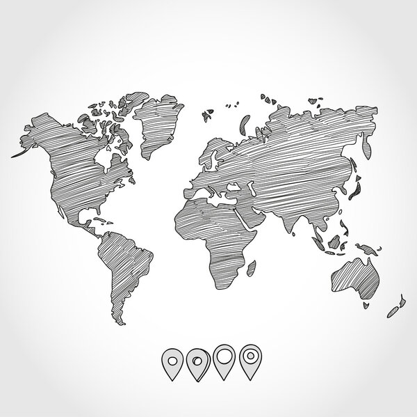 Hand drawn doodle sketch political world map and geo tag pin pointers marker vector illustration
-
 Polygonal abstract World map with connected triangular shapes formed from lines. Good poster for wall in your home. Decoration for room walls.
-
 Detailed political world map vintage style Miller projection
-
 World map vector. Contour of world map
-
 Timezone map
-
 Triangle Map abstract isolated on a white backgrounds
-
 Simple straight line business map of the world, vector background
-
 World Map vector. Gray similar world map blank vector on transparent background. Gray similar world map with borders of all countries and States of USA map, States of Australia and Countries of the UK. Quality world map.
-
 Map illustration of Myanmar with the flag. Cartographic illustration of Myanmar and neighboring countries.
-
 World Map on background, close up
-
 Highly detailed map of the world with countries, big cities and other labels,updated with South Sudan,Kosovo and North Macedonia
-
 North America
-
 World map, Globes with countries. Planet Earth. Vector
-
 Black vector world map with all country borders
-
 Detailed global world map, with borders and names of countries, seas and oceans, vector illustration
-
 A dotted map showcases the Americas, highlighting geographical features and locations in a unique artistic style.
-
 Pacific Centred World Political Map. Countries and capitals, cities, borders and water objects, state outline. Detailed World Map vector illustration.
-
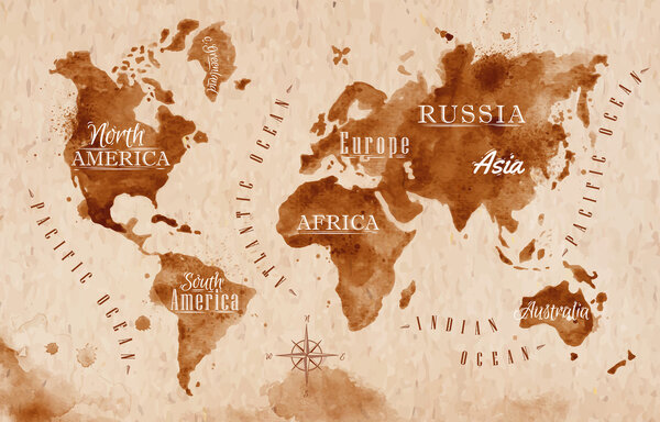 World map map retro
-
 Modern world map connection concept. Vector
-
 Planisphere of the world. Vector illustration.
-
 World Map Atlas International Global Countries
-
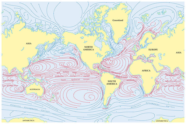 Vector world map of all sea currents
Each vector opens in a new tab with its details. Premium files are sold by Depositphotos; we may earn a commission if you buy. How this works.