Central map state vectors
100 central map state vector illustrations picked from 6.1M royalty-free files, with no more than 3 per artist so you see real variety. Every file is a scalable EPS that opens in Illustrator, CorelDRAW, Affinity Designer and Inkscape, and exports to SVG or PNG at any size.
-
 Vector map of the Central Asian state of Kazakhstan
-
 Vector map of the five states of central asia
-
 Central America and Caribbean islands map classic color, individual states and city whit names vector
-
 Central America map, individual states and capital city with names vector
-
 Road map of the Central American state Belize
-
 Caribbean islands Central America map state names card colors 3D vector
-
 Vector map of the Central American state of El Salvador
-
 Texas state map icons with vector flag stars, blue, red and white stripes, lines and bull head. Silhouettes of Texas map, South Central region of USA country emblems, the lone star state prints
-
 Central America and Carribean states political map. Yellow land with black country names labels on blue sea background. Simple flat vector illustration
-
 The Americas, single states, political map with national borders. Caribbean, North, Central and South America. Different colored countries with English country names. Illustration over white. Vector.
-
 State of Texas, subdivided into 254 counties, outline map. State in the South Central region of the United States, nicknamed The Lone Star State. Isolated, black and white illustration. Vector
-
 Political map of North American countries Canada, United States of America, Mexico with administrative divisions. Central American Countries and Caribbean Region. Colorful blank map. Vector
-
 Central America and Carribean states political map in of grey with black country names labels. Simple flat vector illustration
-
 Highly detailed vector silhouettes of US state maps, Division United States into counties, political and geographic subdivisions of a states, East North Central - Illinois, Indiana, Ohio - set 4 of 17
-
 Highly detailed vector silhouettes of US state maps, Division United States into counties, political and geographic subdivisions of a states, West South Central - Arkansas, Louisiana, Oklahoma - set 12 of 17
-
 Panama map vector silhouette illustration isolated on background. Central America state. Panama flag, national symbol.
-
 Typography composition of city names, silhouettes maps of the states of America, vector detailed posters, Division West South Central - Arkansas, Louisiana, Oklahoma - set 12 of 17
-
 Map of the Economic Community of Central African States (ECCAS).
-
 East North Central states, gray political map with borders and capitals. United States Census division of the Midwest region, consisting of the states Illinois, Indiana, Michigan, Ohio, and Wisconsin.
-
 Outline Nicaragua map
-
 Gray Nicaragua map
-
 Republic of Nicaragua - vector map
-
 Republic of Guatemala - vector map
-
 Vector map with Washim district highlighted in Maharashtra, India
-
 Kazakhstan country detailed editable map
-
 Black and white printable New York city map, poster design, vector illistration.
-
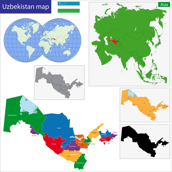 Uzbekistan map
-
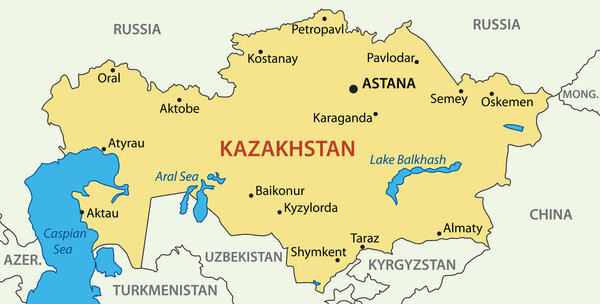 Republic of Kazakhstan - vector map
-
 Republic of Poland isolated maps and official flag icon. vector Polish political map icons with general information. European country geographic banner template
-
 Map of the center-west region of Brazil with the identified states
-
 Czech Republic and Slovakia countries detailed editable map
-
 The detailed map of the Spain with regions or states and cities, capitals
-
 Honduras - detailed map with administrative divisions and country flag. Vector illustration
-
 Kazakhstan vector map with administrative regions and capital with grayscale color on white background
-
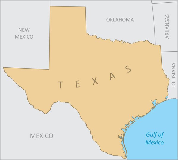 Texas region map
-
 Map of Nicaragua with flag
-
 Blue-gray detailed map of Guatemala administrative divisions and location on the globe. Vector illustration
-
 Kazakhstan map Blank vector map of the Country Borders of Kazakhstan for your infographic Vector
-
 Honduras - highly detailed blue map. Vector illustration
-
 Ukraine geographic divisions, political map. Eastern European country, split into four areas, used in polls, or for reference or statistical purposes. Western, Eastern, Southern and Central Ukraine.
-
 The detailed map of the Brazil with regions or states and cities, capitals.
-
 Location and Map of the Countries of Central America
-
 Political Map of Mexico
-
 Guatemala blank detailed outline map set
-
 Blue similar New York map. New York map blank. New York map vector. New York map flat. New York map template. New York map object. New York map eps. New York map infographic. New York map clean.
-
 Guatemala map with regional division
-
 Central America map with country borders grey illustration
-
 Kazakhstan map with shapes of regions Blank vector map of the Country with regions Borders of the
-
 Guatemala vector map with country name, black on white background.
-
 High detailed map of North and South America
-
 Detailed vector maps of Mexico municipalities (regions and administrative areas) in white color
-
 Large and detailed map of Gilpin County in Colorado, USA.
-
 The detailed map of the Czech Republic with regions or states
-
 List of all flags of Central America
-
 Gulf of mexico road vector map
-
 Vector halftone Dotted map of Peru country for your design, Travel Illustration concept.
-
 Seven Maps Provinces of Costa Rica - alphabetical order with name. Every single map of Province are listed and isolated with wordings and titles. Costa Rica. EPS 10.
-
 Map of Brazil
-
 Latin, Caribbean, North and South American country regions' maps
-
 Central America - map - illustration.
-
 The current map of Kazakhstan. The names of the country, capital, 17 regions and administrative centers in kazakh language. Simplified vector illustration. Political map of the Republic of Kazakhstan
-
 Map of European Union with the indication of Poland
-
 Costa Rica map hand drawn sketch. Vector concept illustration flag, childrens drawing, scribble map. Country map for infographic, brochures and presentations isolated on white background. Vector
-
 Central America - map, navigation icons - illustration.
-
 Mexico map highlighted in Mexico flag colors
-
 Concept map of Texas
-
 South Kazakhstan Region (Republic of Kazakhstan, Regions of Kazakhstan) map vector illustration, scribble sketch Turkistan ma
-
 North America high detailed vector map with states borders of Canada, USA and Mexico. All elements separated in detached layers
-
 Map of Poland
-
 Detailed map of US regions, isolated states with names, Colorful infographics of the United States of America, vector illustration
-
 Outline maps of American countries collection, black lined vector map.
-
 Central Bosnia Canton (BiH, Federation of Bosnia and Herzegovina, FBiH) map vector illustration, scribble sketch Central Bosnia map
-
 Tajikistan map vector, Tajikistan flag vector, isolated Tajikistan
-
 Belize high detailed map Country silhouette icon Isolated Belize black map outline Vector
-
 United states time zones map
-
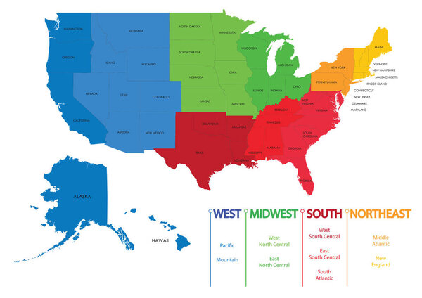 Map of US regions. Maps USA
-
 Map of Luanda, satellite view, black and white map. Street directory and city map. Africa
-
 Texas state icon map set
-
 Gulf of America simple map. The Gulf of Mexico may be renamed The Gulf of America.
-
 Western Africa vector map high detailed silhouette illustration isolated on white background. Western Africa regional map with separated borders without country members. Cote d Ivore map.
-
 North America map. Monochrome North America icon
-
 Central Canada region location within Canada 3d isometric map
-
 France map icon for your design
-
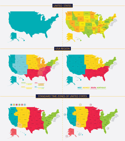 United states. Standard time zones of united states. USA region
-
 North America - map - illustration.
-
 Abstract vector color map of Democratic Republic Congo
-
 Costa Rica Map and Colorful Map Markers
-
 Vieques island municipality (Commonwealth of Puerto Rico, Porto Rico, PR, Unincorporated territories of the United States) map vector illustration, scribble sketch Isla de Vieques map
-
 North and South America vector map country infographics. 24 slide presentation templates. United States, Canada, Brazil, Mexico, Argentina and more.
-
 Czech Republic and Slovakia map
-
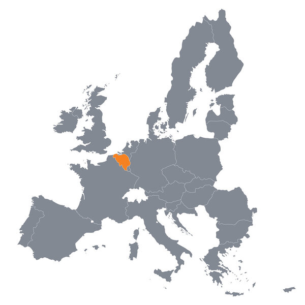 Map of European Union with the indication of Belgium
-
 Europe map without names of countries
-
 North and Central American flag set
-
 Europe with highlighted Austria map.
-
 Czech Republic isolated map and official flag icons. vector Czech political thin line style map. European country geographic banner template. travel and business concept maps
-
 Fourteen Maps Regions of Czech Republic - alphabetical order with name. Every single map of Province are listed and isolated with wordings and titles. Czech Republic. EPS 10.
-
 Fresno on California State Map. Detailed CA State Map with Location Pin on Fresno City. Black silhouette vector map isolated on white background.
-
 Russian Federation Map
-
 Costa Rica Administrative Map and Flat Pin Icons
-
 Europe and European Union map with indication of Latvia
Each vector opens in a new tab with its details. Premium files are sold by Depositphotos; we may earn a commission if you buy. How this works.
