Central map capital vectors
99 central map capital vector illustrations picked from 6.7M royalty-free files, with no more than 3 per artist so you see real variety. Every file is a scalable EPS that opens in Illustrator, CorelDRAW, Affinity Designer and Inkscape, and exports to SVG or PNG at any size.
-
 Central Asia, political map with capitals. Subregion of Asia, consisting of former Soviet republics stretching from Caspian Sea to China and Mongolia, and from Afghanistan and Iran to south of Russia.
-
 Central America map, individual states and capital city with names vector
-
 Central America map. High detailed political map Central American and Caribbean region with country, capital, ocean and sea names labeling
-
 Eastern Europe and Western Asia, gray political map, with capitals and borders. With the Black Sea, Caspian Sea, European Russia, and with a part of Central Asia. Illustration on white background.
-
 Central America and Caribbean islands map, states and capital city with names, white on background vector
-
 Republic of the Congo, political map. Also known as the Congo, is a country located on the western coast of Central Africa, to the west of the Congo River, with the capital Brazzaville. Vector.
-
 Central America map - green hue colored on dark background. High detailed political map Central American and Caribbean region with country, capital, ocean and sea names labeling
-
 Vector map of the Central Asian state of Kazakhstan
-
 Amsterdam colored vector map
-
 Map of Luanda, satellite view, black and white map. Street directory and city map. Africa
-
 Buenos Aires map poster, administrative area plan view. Black, white and blue detailed design map of Buenos Aires city with rivers and streets. Outline silhouette of metropolitan cityscape.
-
 Black and white printable New York city map, poster design, vector illistration.
-
 Santiago One Color Map
-
 Metro de Santiago vector map.
-
 Republic of Nicaragua - vector map
-
 Administrative and political vector map of agglomeration santiago Chile.
-
 Republic of Guatemala - vector map
-
 Central London Vector Map
-
 Kazakhstan country detailed editable map
-
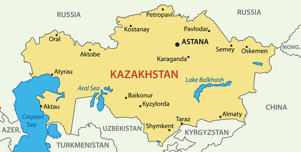 Republic of Kazakhstan - vector map
-
 Map of Cuba - Highly Detailed Vector illustration
-
 Lisbon city plan, detailed vector map
-
 Colored plan map of Moscow, aerial view
-
 Central Asia vector map infographic template divided by countries. Slide presentation
-
 Moscow administrative map.
-
 Czech Republic and Slovakia countries detailed editable map
-
 Central America and Caribbean islands map classic color, individual states and city whit names vector
-
 Honduras - detailed map with administrative divisions and country flag. Vector illustration
-
 Kazakhstan blueprint map template with capital city Astana marked on blueprint Kazakhstani map
-
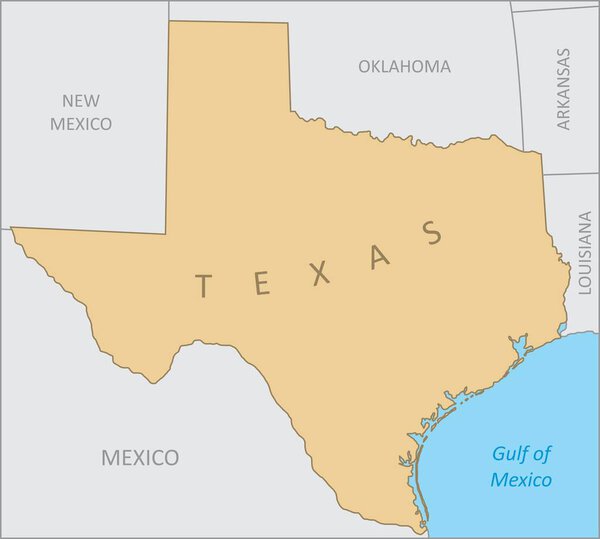 Texas region map
-
 The detailed map of the Brazil with regions or states and cities, capitals.
-
 Honduras - detailed map with administrative divisions country. Vector illustration
-
 Ukraine administrative map puzzle
-
 High detailed Mexico physical map with labeling.
-
 Blue similar New York map. New York map blank. New York map vector. New York map flat. New York map template. New York map object. New York map eps. New York map infographic. New York map clean.
-
 The detailed map of the Brazil with regions or states and cities, capitals, national flag
-
 Highly detailed Serbia physical map with labeling.
-
 Central Asia
-
 Vector political map of Latin America
-
 The detailed map of the Brazil with regions or states
-
 Map of Bursa, Turkey, satellite view, black and white map. Street directory and city map. Asia
-
 Detailed Serbia road vector map with labeling
-
 South America - map - illustration.
-
 Texas state map icons with vector flag stars, blue, red and white stripes, lines and bull head. Silhouettes of Texas map, South Central region of USA country emblems, the lone star state prints
-
 America with selected El Salvador map and El Salvador flag icon.
-
 Czech Republic Administrative Map and Roads
-
 Gulf of mexico road vector map
-
 China regions map, vector illustration
-
 Central America map - brown orange hue colored on dark background. High detailed political map Central American and Caribbean region with country, ocean and sea names labeling
-
 Map of Brazil
-
 Vector map of South America Continent with Countries, Capitals, Main Cities and Seas and islands names in brilliant colors.
-
 Central America - highly detailed map.
-
 Central America - map - illustration.
-
 Europe Map in Colors of Blue and Map Markers
-
 Vector map of the city of Ankara, Turkey
-
 Continents vector maps country infographics set. Slides presentation templates with flags
-
 Map of Tijuana, satellite view, black and white map. Street directory and city map. Mexico, California
-
 Central vienna (wien) city map illustration
-
 South America Detailed Map
-
 South America Political Map
-
 Greece administrative map isolated on white background
-
 Digital map of El Salvador. Illustrated with dynamic grid network.
-
 South America Detailed Political Map Isolated On White
-
 Map of the city of Antalya, Turkey
-
 North and South America vector map country infographics. 24 slide presentation templates. United States, Canada, Brazil, Mexico, Argentina and more.
-
 Czech Republic Administrative Map and Colored Map Icons
-
 Detailed map of the Germany with cities
-
 Poland map
-
 Asia with selected Uzbekistan map and Uzbekistan flag icon.
-
 European Union map with all europe countries and capital name
-
 Warsaw City (Republic of Poland) map vector illustration, scribble sketch City of Warsaw map
-
 Africa map
-
 Outline map of Czech Republic
-
 Europe with highlighted Austria map.
-
 Gulf of America simple map. The Gulf of Mexico may be renamed The Gulf of America.
-
 Central Canada region location within Canada 3d isometric map
-
 Kazakhstan map icon illustration symbol design
-
 Panama - detailed map with administrative divisions and country flag. Vector illustration
-
 Burkina Faso higt detailed map with subdivisions. Administrative map of Burkina Faso with districts and cities name, colored by states and administrative districts. Vector illustration with editable and labelled layers.
-
 Vector map Czech Republic. Isolated vector Illustration. Black on White background. EPS 10 Illustration.
-
 Republic of Poland isolated map and official flag icons. vector Polish political maps icons. Central Europe country geographic banner template
-
 Isometric map of Democratic Republic of the Congo detailed vector illustration
-
 Isometric map of Costa Rica detailed vector illustration
-
 Map of Switzerland in the globe
-
 Isometric map of Central African Republic detailed vector illustration
-
 Travel map of Vienna, Austria with landmarks
-
 Vector New York state Map silhouette. Isolated vector Illustration. Black on White background.
-
 Panama map with shadow effect presentation
-
 Taiwan Earthquake concept on cracked map
-
 Costa Rica map flag vector silhouette illustration isolated on white background. Central America country. Costa Rica map national emblem symbol.
-
 Central African Republic vector map with infographic elements, p
-
 Low poly Visegrad Four map. Group of middle Europe states - Slovakia, Poland, Hungary, Czech republic
-
 Map of Czech Republic
-
 Blue similar France map with capital city Paris. France map blank. France map vector. France map flat. France map template. France map object. France map eps. France map infographic. France map clean
-
 ������������
-
 Kazakhstan
-
 Layered editable vector illustration of the subway diagram of Washington,DC,USA.
-
 Isometric city
-
 ������������
Each vector opens in a new tab with its details. Premium files are sold by Depositphotos; we may earn a commission if you buy. How this works.