Central cartography map vectors
100 central cartography map vector illustrations picked from 6.7M royalty-free files, with no more than 3 per artist so you see real variety. Every file is a scalable EPS that opens in Illustrator, CorelDRAW, Affinity Designer and Inkscape, and exports to SVG or PNG at any size.
-
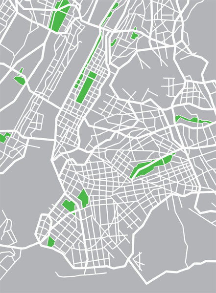 Vector illustration map of New York
-
 Vector map of the Central Asian state of Kazakhstan
-
 Russia map
-
 Amsterdam colored vector map
-
 Buenos Aires map poster, administrative area plan view. Black, white and blue detailed design map of Buenos Aires city with rivers and streets. Outline silhouette of metropolitan cityscape.
-
 Map of Luanda, satellite view, black and white map. Street directory and city map. Africa
-
 Black and white printable New York city map, poster design, vector illistration.
-
 Highly detailed physical map of Russia,in vector format,with all the relief forms,regions and big cities.
-
 Metro de Santiago vector map.
-
 Outline Nicaragua map
-
 Ukraine geographic divisions, political map. Eastern European country, split into four areas, used in polls, or for reference or statistical purposes. Western, Eastern, Southern and Central Ukraine.
-
 Gray Nicaragua map
-
 Administrative and political vector map of agglomeration santiago Chile.
-
 Dotted map of Russia. Vectoreps10.
-
 Central London Vector Map
-
 Central Asia, or Middle Asia, colored political map. Region of Asia from Caspian Sea to western China, and from Russia to Afghanistan. Kazakhstan, Kyrgyzstan, Tajikistan, Turkmenistan, and Uzbekistan.
-
 Map of the city of Cincinnati, State Ohio, USA, , and is the government seat of Hamilton County
-
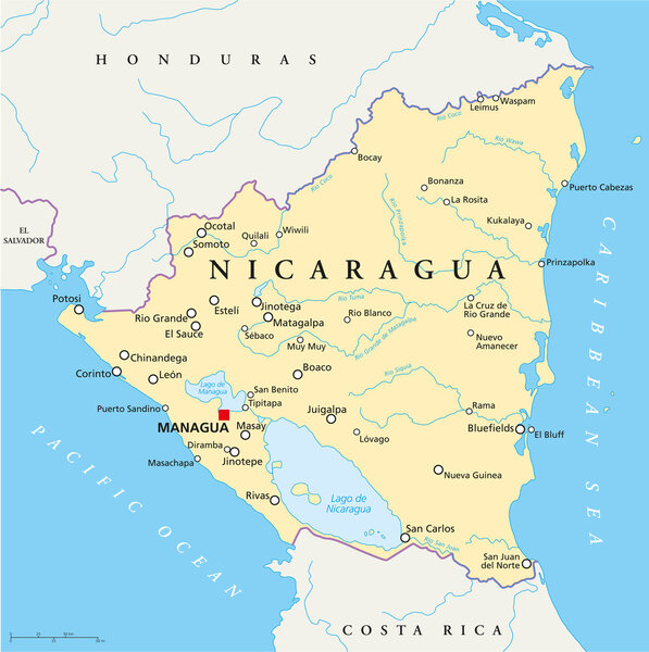 Nicaragua Political Map
-
 North and Central America
-
 Black and white vector city map of New York with well organized separated layers.
-
 Map of the center-west region of Brazil with the identified states
-
 Kazakhstan country detailed editable map
-
 Lisbon city plan, detailed vector map
-
 Colored plan map of Moscow, aerial view
-
 Republic of Poland isolated maps and official flag icon. vector Polish political map icons with general information. European country geographic banner template
-
 Blue map of Americas
-
 Czech Republic and Slovakia countries detailed editable map
-
 Vector map of the city of Dubai, United Arab Emirates, UAE, Dubai-Sharjah-Ajman metropolitan area
-
 Political map of Americas in grey on white background. North and South America with country labels. Simple flat vector illustration
-
 Central America and Caribbean islands map classic color, individual states and city whit names vector
-
 The detailed map of the Spain with regions or states and cities, capitals
-
 Map of the city of Cologne, Germany
-
 Honduras map
-
 3 dimensional infographics political map of South America
-
 Nicaragua highly detailed physical map
-
 Honduras - highly detailed blue map. Vector illustration
-
 Central America map, individual states and capital city with names vector
-
 Central America map. High detailed political map Central American and Caribbean region with country, capital, ocean and sea names labeling
-
 Location and Map of the Countries of Central America
-
 Blue-gray detailed map of Guatemala administrative divisions and location on the globe. Vector illustration
-
 Honduras - detailed map with administrative divisions country. Vector illustration
-
 High detailed Mexico physical map with labeling.
-
 Central america map
-
 Guatemala blank detailed outline map set
-
 Highly detailed vector map of Belize with administrative regions, main cities and roads.
-
 Vector political map of Latin America
-
 Guatemala vector map with country name, black on white background.
-
 Map of Bursa, Turkey, satellite view, black and white map. Street directory and city map. Asia
-
 Detailed vector maps of Mexico municipalities (regions and administrative areas) in white color
-
 Political color map of Asia with borders of the states.
-
 Detailed Serbia road vector map with labeling
-
 Large and detailed map of Gilpin County in Colorado, USA.
-
 Infographics Central America map outline, flat design, color blue vector
-
 Gulf of mexico road vector map
-
 Central America and Carribean states political map. Yellow land with black country names labels on blue sea background. Simple flat vector illustration
-
 Vector halftone Dotted map of Peru country for your design, Travel Illustration concept.
-
 China regions map, vector illustration
-
 Central America - highly detailed map.
-
 Vintage Color Map of Paraguay
-
 Turkmenistan highlighted on a detailed map, geographic location of Turkmenistan.
-
 Vector high detailed map of Germany metropolitan regions (areas)
-
 Europe Map in Colors of Blue and Map Markers
-
 Map of Tijuana, satellite view, black and white map. Street directory and city map. Mexico, California
-
 Central vienna (wien) city map illustration
-
 Location Map of Sao Toma and Principe on map Africa. 3d Sao Toma and Principe flag map marker location pin. High quality map of DR Sao Toma and Principe. Africa. EPS10.
-
 Zoom on Kyrgyzstan Map and Flag. World Map.
-
 Map of the World. Vintage Style. Large Detailed World Map vector illustration.
-
 Kazakhstan network map.
-
 High Detail Central america Green vector Map Set
-
 A dotted map of Central America, featuring countries like Guatemala, Honduras, and Costa Rica, with a minimalist design. The map is composed of small black dots on a white background.
-
 Czech Republic Physical Map. No text
-
 Political Caribbean and Central America Map vector illustration with different colors for each country. Editable and clearly labeled layers.
-
 A map of the american continent with the central america and the caribbean highlighted
-
 World Map climate highly detailed
-
 Political Caribbean and Central America Map vector illustration with countries in white color. Editable and clearly labeled layers.
-
 World Map climate zone and animal highly detailed
-
 Map of North and South America
-
 Belize handdrawn map Colourful sketchy country outline Captivating Belize map with provinces
-
 The detailed map of Panama with regions or states and cities, capital. Administrative division
-
 GRAY CMYK color map of EUROPE
-
 Europe Map in Colors of Blue
-
 Doodle Map of Central America and Mexico
-
 World Map - Infographic Set
-
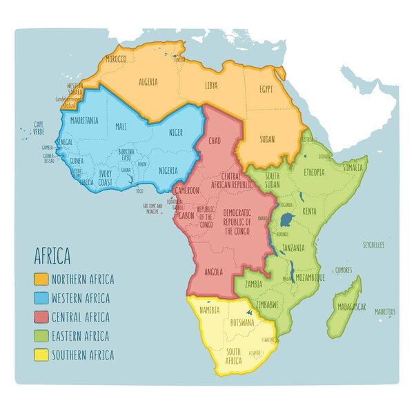 Colorful hand drawn political map of Africa with five regions
-
 Location Guna Yala Comarca on map Panama. 3d location sign similar to the flag of Guna Yala. Quality map with Regions of the Panama for your design. EPS10
-
 Map of Central African Republic with borders
-
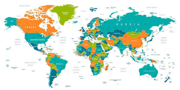 World Map - illustration
-
 Vector map of Turkey with regions and geographical divisions, and neighbouring countries. Editable and clearly labeled layers.
-
 African Country Shapes with Flags on a Highlighted World Map
-
 North and South America outline world map, vector illustration isolated on white. Map of North and South America continent, line silhouette concept
-
 The detailed map of Panama with regions or states. Administrative division
-
 Mexico Regions Map Line Vector
-
 Italy regions black outline map. Vector map. Italy regions.
-
 Chinandega Department (Republic of Nicaragua, Departments of Nicaragua) map vector illustration, scribble sketch Chinandega (NI-CI) ma
-
 Editable map of Africa with all countries.
-
 City map
-
 Greece provinces and regions vector map with neighbouring countries and territories
-
 World Map highly detailed
-
 Blank map Czech. High quality map Czech with provinces on transparent background for your web site design, logo, app, UI. Stock vector.
-
 The map of Mexico is highlighted in red on the world map - Vector illustration
Each vector opens in a new tab with its details. Premium files are sold by Depositphotos; we may earn a commission if you buy. How this works.
