Atlas map vectors
100 atlas map vector illustrations picked from 12.8M royalty-free files, with no more than 3 per artist so you see real variety. Every file is a scalable EPS that opens in Illustrator, CorelDRAW, Affinity Designer and Inkscape, and exports to SVG or PNG at any size.
-
 Vector World map with colorful continents Atlas - EPS
-
 Global vector world map isolated on white background. Simple worldmap silhouette or earth atlas with schematic outlines of continents
-
 World map, colorful countries atlas EPS10 vector file.
-
 World map with labeling.
-
 World map
-
 Vector high detailed world map
-
 Dotted world map
-
 World map in grey color on white background. High detail blank political map. Vector illustration with labeled compound path of each country
-
 World Map vector. Gray similar world map blank vector on transparent background. Gray similar world map with borders of all countries and States of USA map, States of Australia and Countries of the UK. Quality world map.
-
 Light gray detailed world map
-
 Urban vector city map of SanJose, California, United States of America
-
 Seamless pattern in the form of abstract city map. Vector repeating flat illustration with a city road plan. Decorative map with town streets, green parks and a blue river. Color schematic background
-
 Map city, gps navigator. City area vector background map, streets and water cartography illustration. Widescreen proportion, digital flat design streetmap. Top view. Abstract transportation. Detailed view of city from above.
-
 Abstract line world map
-
 Fictional city map navigation
-
 Urban vector city map seamless texture
-
 Vector world map illustration in polygonal style
-
 Map USA vintage
-
 Vector color worldwide map of local time zones
-
 Map of standard time zones of the world with continents separately and clocks with current local times in main world cities
-
 Detailed World map standard time zones
-
 World map dot illustration
-
 World map illustration infographics
-
 World map with color points
-
 Digital map of Cuba. Illustrated with dynamic grid network.
-
 Atlant Atlas holds earth quality stylized logo for your company vector trendy style flat
-
 Watercolor world map in vector.
-
 Map of the city of Rostov-on-Don, Russia
-
 World map polygon on dark background
-
 World map with country name
-
 Hand drawn world map in three versions
-
 Vector of Djibouti country outline silhouette with flag set isolated on white background. Collection of national flag icons with square, circle, rectangle and map shapes.
-
 Vector of Botswana country outline silhouette with flag set isolated on white background. Collection of national flag icons with square, circle, rectangle and map shapes.
-
 Vector of Guinea country outline silhouette with flag set isolated on white background. Collection of national flag icons with square, circle, rectangle and map shapes.
-
 Political world map isolated on white background, vector illustration
-
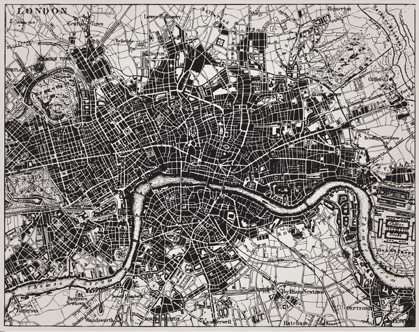 Historical map of London, England.
-
 Dark green map of Europe.
-
 World map map retro
-
 World road map with labeling
-
 Political World Map with flat icons and globes.Vintage colors
-
 Elements for the news infographic with map
-
 World travel map vector illustration
-
 Molucca Sea on the world map. Vector illustration.
-
 Political World Map vector illustration isolated on white background with country names in spanish. Editable and clearly labeled layers.
-
 Physical World Map Retro Colors with labeling
-
 Earth, globe icon. Vector. World map isolated on white background.
-
 VINTAGE WORLD MAP
-
 High detail world map. vector illustration of earth map
-
 Political World Map with navigation icons
-
 Blue circles world map background
-
 Political world map on white background, with every state labeled and selectable (labeled in Layers panel also). Versatile file, turn on an off visibility and color of each country in one click.
-
 World map infographic with map pointers - Template vector design
-
 High Detail World map.
-
 Dotted World maps and globes
-
 Map Europe vintage
-
 American flag on a map of the USA
-
 Freehand drawing world map sketch on white background. Vector illustration.
-
 World map with most important circles of latitudes and longitudes, showing Equator, Greenwich meridian, Arctic and Antarctic Circle, Tropic of Cancer and Capricorn. English. Illustration. Vector.
-
 City map colored illustration for navigation program or mobile app. City layout map vector illustration.
-
 Medieval world map. Old paper with painted continents and meridians with wind rose antique geography.
-
 Map Latin America. Poster map of Latin America. Black and white print map of Latin America for t-shirt, poster or geographic themes. Hand-drawn graphic map with countries. Vector Illustration
-
 World map modern.Globe map.Generalized world map.World map on isolated background.Vector Illustration eps
-
 Map of the world silhouette
-
 World single states political map
-
 White world map isolated on gray bkg
-
 World map vector neon with borders.
-
 Map vector icon. Flat style illustration. EPS 10 vector.
-
 Map Special lineal color icon. Illustration symbol design template for web mobile UI element. Perfect color modern pictogram on editable stroke.
-
 Modern Globe Map in Black Color Isolated on White Background. Vector Illustration
-
 Grey blank world map.
-
 World Map Vector, Scribble Effect, Isolate on Blank Background, Flat Earth Map For Website, Annual Report, Infographics, World Map Illustration, Vector Illustration
-
 Urban vector city map of Bydgoszcz, Poland
-
 3d map of Russia with borders of regions
-
 Map silhouette of lights on dark background
-
 Colorful world map made by balls and lines, vector illustration
-
 Urban vector city map of Moscow, Russia
-
 World Map creative low poly style continents Vector illustration
-
 Colorful Italy political map
-
 Highly detailed world map with labeling. ��ountries in different
-
 Map of Russia
-
 World Map Vector. Detailed illustration of worldmap
-
 Abstract Europe map
-
 Dollar world map.
-
 World map, political, in high details. Vector illustration.
-
 Detailed Physical World Map with labeling. No bathymetry
-
 City map navigation
-
 World map in the triangulation, social, business.
-
 Blank white political world map isolated on black background. Worldmap Vector template for website, infographics, design. Flat earth world map illustration.
-
 Blank black world map on isolated background. World map vector template for website, infographics, design. Flat earth world map illustration
-
 Hatched map of the world
-
 Pencil hand drawn China map vector on paper illustration
-
 Medieval cartography, old pirate treasure map, vector illustration
-
 Asia -highly detailed map.
-
 Navigation map icons.
-
 World Political Map Outline
-
 Map of the city of Helsinki, Finland
-
 Map of World dark grey vector silhouette. High detailed map on light background
-
 Low poly world map
-
 World map with pointer isolated on blue background. Vector Illustration
-
 Abstract world map. Colorful background. Vector illustration. Eps 10
Each vector opens in a new tab with its details. Premium files are sold by Depositphotos; we may earn a commission if you buy. How this works.
